


 |
 |
 |
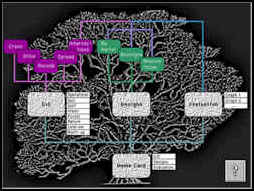 |
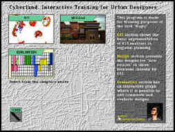
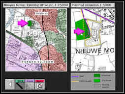
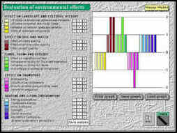
SUMMARY This project intends to teach students the basics of GIS implementation in land evaluation appropriate for physical planning purposes. As it is a multimedia document it will also have to demonstrate new ways of a non-linear presentation of designs. The project "Multimedia GIS as a design tool with a case study of new estates in West-Brabant" will be used as an interactive program to be applied in education in the block "Region" of the Department of Urban planning of the Faculty of Architecture. Interaction between the students and the system will enable an evaluation of designs, produce an immediate graphic visualisation of their evaluations and enable comparison with the evaluations of fellow students. Data bases for this project will be taken over from a post-graduate project in which GIS software MAP II has been used to select locations for the "new estates" in West-Brabant. |